Update: After a long legal battle, the River Place Nature Trail survived closure a few years back. Now the trail may effectively be closed to non-residents with a high fee plan instituted on the weekends. See the timeline of events documenting the travails of one of Austin's best trails.
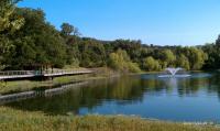
The southern trailhead features a boardwalk along the edge of a nice pond.
Hiked just about every trail in the Austin area and looking for something new or challenging? The River Place Nature Trail just might be the trail you've been looking for.
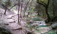
Much of the trail follows along stream beds through the canyon.
This new trail was created by the Municipal Utility District that serves the River Place neighborhood. In a word, the trail is fantastic. There are some steep elevation gains and descents that are mitigated somewhat by the ubiquitous placement of steps and stairs.
One of three trailheads are located on Big View Drive across the street from the tennis courts and small soccer fields. The trailhead here includes a nice kiosk detailing the trail map and animals that one might find along the trail.
The first section of the trail is a boardwalk that follows the boundary of a retention pond. You'll find lots of turtles here and sometimes folks that are fishing. The trail soon turns rough and disappears into the brush uphill.
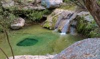
A few spots here and there feature nice waterfalls and interesting formations like this depression in the stream bed.
This first section of trail is referred to as Lower Panther Trail, named after the surrounding area, Panther Hollow. How did this name come about? When the area was still a working ranch several dead goats kept turning up near cave entrances. Ranch hands tracked down a Mountain Lion in this area thought to be responsible for the kills and dispatched it. There have been no Mountain Lion sightings in the area for quite some time.
The trail surface is hard pack and rock. It's uneven and often hugs the side of steep slopes above Panther Hollow creek. The trail builders used a lot of logs to buttress the downhill side of the trail for stabilization. It obviously required a lot of work to put this trail into place.
About a half mile into the hike there's a junction point that leads into two possible directions. To the right is the trail segment marked as Little Fern Trail. It leads to one of two trailheads along River Place Blvd.
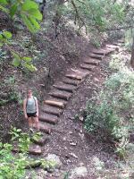
Did we mention that there are lots of stairs on this trail?
If one takes the Little Fern Trail option, there's is yet another another trail segment option. The Water Line Trail parallels Lower Panther Trail on the opposite side of the creek. Unlike the rest of the trail system, this segment is relatively flat and wide open to the sky. It's really more of a utility service path, but it's an option none the less.
The main option continues north and encompasses the newest addition to the trail system which includes trail segments entitled Upper Panther Trail and Canyon Trail. Here you'll find the roughest terrain with the biggest elevation variation. Expect quite a stairmaster-like workout as you descend into and ascend out of creek beds and ravines.

The northern portions of the trail feature a couple of vistas, otherwise your path is well sheltered by trees and brush.
The northern sections of trail also feature a few vista views of the surrounding canyon lands and the River Place golf club below. According to the official maps there are a couple of emergency exits onto the golf course along the northern trail segment.
The northern trail segment also empties out onto River Place Blvd. Although the River Place Blvd. trailheads lack explicit parking, there is space along the road to park.
In looking at the satellite views of the area it's quite possible that the trail system here could be expanded a bit further, though I have seen no plans put forward to do this. Whether the mileage gets increased or not, this trail is worth the visit.