Roy E. Larsen Sandyland Sanctuary Photos
Return to Roy E. Larsen Sandyland Sanctuary
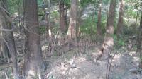
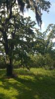
As expected, lots and lots of Cypress along the creek bottom (Photo by
CraigS)
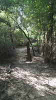
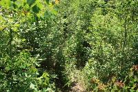
This is typical of most of the trail (Photo by
CraigS)
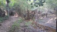
One of many sloughs along the way (Photo by
CraigS)
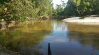
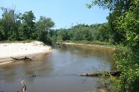
A view of Village Creek along the Flood Plain trail (Photo by
CraigS)
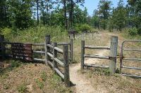
This is a the trail head of Sandyland (Photo by
CraigS)
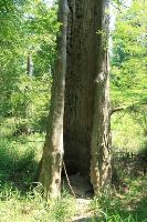
The highlight of the Floodplain Trail was finding this massive, hollowed out tree dotted with woodpecker holes. It must have been 6-7 feet in diameter. My 4' hiking stick provides some scale as to its size. (Photo by
Blaze)
At times when the trail was hard to find, these small circular direction markers pointed the way. (Photo by
Blaze)
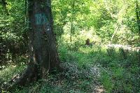
Beware of snakes in the high grass down along the creek. (Photo by
Blaze)
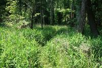
The Floodplain Trail was overgrown with vegetation and in need of maintenance. It was hard to find the trail at times. (Photo by
Blaze)
The Floodplain Trail takes you down to and along Village Creek. (Photo by
Blaze)
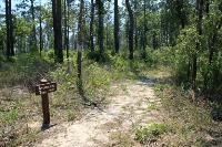
The Longleaf Nature Trail is a short loop with numbered exhibits. (Photo by
Blaze)
Signage on the Sandhills Trail was good with direction signs pointing the way. (Photo by
Blaze)
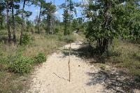
The sand is thick enough in places to stick your hiking pole into it. Walking through this sand is challenging. (Photo by
Blaze)
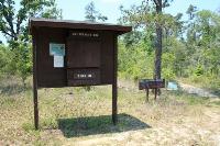
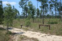
Printed trail maps and brochures to the interpretive Longleaf Nature Trail can be obtained here. (Photo by
Blaze)
This is the trailhead. Note: At the first fork, go left! (Photo by
Blaze)

This is the sign at the entrance off of Hwy 327. (Photo by
Blaze)