I went back to Brays Bayou to finish the western half of the trail. It completes the hike I did a few days earlier on the eastern half of Brays Bayou. You can read my log of that hike here.
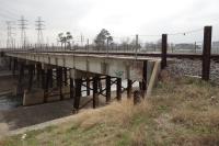
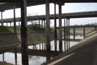
I started this hike at Buffalo Speedway (the point where I turned around from my previous hike) and hiked west along the northern bank. The hike took me past Hwy 610 and ended just beyond Braeburn Glen Park near Hwy 59. I returned along the southern bank of Brays Bayou.
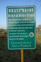
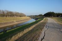
The signage on this half of the trail is better than the eastern half. There are a few "Brays Bayou Hike & Bike" trail signs posted whereas I did not see any of those on the eastern half. The official trail is a pave concrete walkway that jumps from one side of the bayou to the other, but the non-paved side of the bayou is easily passable so I decided to stick to one side of the bayou in each direction to provide some more variety. The only downside is I had to long jump some drainage gullies occassionally. Fortunately, the water level was not very high.
I started this hike late (2pm) so I ended up finishing the last hour of this hike in the dark. Hiking along the bayou at night is an interesting experience.