Columbia Tap
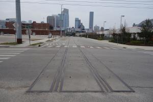
Where the trail ends on the northern terminus, you can still see the old railroad tracks.
User:
Blaze
- 2/6/2014
Location:
Columbia Tap Rail-Trail
Rating:

Difficulty:

Solitude:
Miles Hiked: 8.50 Miles
Elapsed Time: 2 hours, 34 minutes
Log Photos
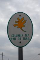
Trail Sign
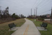
View Of The Trail

Graff

End Of The Trail

View Of Downtown

Third Ward