Getting there: From MoPac Expressway in west Austin, turn onto William Cannon and head east. Turn left onto Brodie Lane and head south. Turn left at the first street, which is Paisano Trail. This narrow road will turn a couple of times to the right and left until it parallels LongView Park. Look for parking on the left. The Stephenson Preserve
trail begins in LongView.
The Hike: The hike begins at the waypoint "Trailhead", which is actually in
the adjoining LongView Park. The trail starts near swings, a basketball court, a pavilion
and picnic tables, the usual park fare. The trail at the start here is paved and not
particularly interesting. Where possible, head to the north onto the packed dirt paths to
get to the preserve.
-small.jpg)
The trail in Longview Park itself is paved and easy as can be.
The Stephenson Preserve is part of the City Of Austin's Central and Eastern Preserves group,
and as such the land is supposed to serve as a sanctuary for native plants and animals.
However, Stephenson is either new to the Austin system or budget problems have curtailed
any visible efforts to keep human impact on the land low.
Contrary to the official park map, the trails at Stephenson are not the simple out and back
path that it shows. Instead, a twisted, criss-crossed web of trails come and go from all
directions. The reason for this spaghetti factory is prior use by motorcyclists who cut a
swath of denuded dirt where once grasses, bushes and trees grew. Neither motorcycles nor
bikes are now allowed on the preserve and I'm sure they would like you to report any such
activity. The city has plans to heal the damage and restore the area to a more natural
state. In the years ahead this preserve should get better with age.

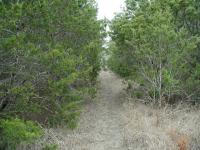
The trail in the preserve itself is either dirt or rock. And the trees close in on occasion.
Although overuse has caused a portion of the preserve to resemble a damaged lunar landscape,
the majority of the preserve maintains some sense of solitude. On my trip I encountered no
motorcycles or bikes, just a total of four people strolling along the trails.
The elevation changes are not too drastic and the trail is well worn and easy to follow.
The hardest part of the hike was determining which way to go. As easy as it is to get
turned around by the tangled trails, I was happy to have my GPS with me so as make
sense of where I'd already hiked.
-small.jpg)
The preserve used to be a working ranch, as evidenced by the remains of these pens.
The preserve is a mixture of Juniper and Oak clumps and pocket prairies with open sky.
Once this property was ranch land and there exists evidence of that use today in the form of
rock walls and animal pens. The pens are located near the center of the preserve and the
rock walls can be found in several places all around the property.
Hikers want lots of trails, but not necessarily overlapping each other. So hopefully as the
city turns Stephenson into a proper preserve the trail system will be shrunk and the lunar
landscape nurtured back a more natural state. Even so, Stephenson Preserve is large enough
to allow the visitor to put the traffic of William Cannon and the damage to part of the
preserve behind them.