Ray Roberts Greenbelt Corridor

Trail
22.00 Miles
N/A
N/A
3stars (3.23)15
1star (1.40)
2point5stars (2.67)
N/A
Yes
No
N/A
100 PW 4137
Pilot Point
Denton
More Info
Photos
Lenore strutting her stuff.
Nice paved trail. (Photo by Eveline)
Log Entries
Nice trail to spend some time on
By rodavenport on 6/7/2014
Rating: 3stars Difficulty: 1star Solitude: 1star
Distance: 20.00 Miles Duration: N/A

This Trail is just out side the city limits of Denton. I actually hiked it on two different days. The first day I went from the 380 TH to the midpoint then double back. The next weekend I hiked from the TH @ Ray Roberts dam back down to the midpoint then doubled back. The trail was very active with other users. I general mix of hikers, trail runners and bike riders with the heaviest concentration of people in the southern half of the trail. The trail is very flat not much up and down at all since it runs in the flats right next to the Elm Fork. Lots of shade in the southern half and lots of sunshine in the northern half. The northern half gets pretty hot with all of the sunshine so early mornings or late evenings is probably the best. All in all a nice hike and I will probably do it again in the future.

An easy trail, great for looking at flowers and watching the large birds.
By chrybee on 4/29/2012
Rating: 3stars Difficulty: 1star Solitude: 2stars
Distance: 6.00 Miles Duration: N/A
I was passed by a lot of bikes on the trail. The trail goes on a good distance more than I went. I visited the historic McKinney bridge that Bonnie and Clyde used as a getaway after they robbed the bank in Pilot Point, TX. Good tree coverage for the first mile then a winding trail through grassland. My advice lots of water and a hat.
Nice day hike
By krampus on 10/22/2011
Rating: 2point5stars Difficulty: 1point5stars Solitude: 2stars
Distance: 11.00 Miles Duration: N/A

Went with a group of scouts for a day hike. Parked in the lot near the dam and walked to 428, had lunch and came back. The "improved" trail on the west side of the creek is fairly nice. It is mostly packed gravel and dirt but does have concrete in some sections. There are a few shade spots near the creek as you head south within 1.6 miles of the dam. The best place is by the Bonnie & Clyde Bridge. After that, there is little shade right on the trail until you reach 428. There are a few picnic tables at the 428 rest area, along with a bathroom and potable water from the water fountains. Along the trail there is no potable water at all, so pack what you need to get to 428. Cell service is pretty good along the trail.

NOTE: The native trail on the east side of the creek is undergoing rennovation from errosion at the time of this post. Our crew went .5 miles or so down the trail on that side before we found out it was closed; hence the 11 miles trekked.

Great trails.
By frk on 1/13/2010
Rating: 5stars Difficulty: 2stars Solitude: 4stars
Distance: 9.00 Miles Duration: 3 hours, 50 minutes

I hiked from Elm East to FM 428 on the biking/hiking trail and took the equestrian/hiking trail back to my car.  The TPWD map gives a distance of 4.5 miles between these two points.  I give a difficulty score of "2" as an average of the two trails: a "1" for the biking/hiking trail and a "3" for the horse/hiking trail.

The biking/hiking trail is a usually dirt road sometimes paved with gravel and, once in a while, concrete. The northernmost mile is forested, but the rest runs alongside pastureland at the edge of the woods around the river.  This might have been an unbearably sunny hike in August, but in January it was a great time to enjoy lots of plant and animal life. Coming this way, I saw a great variety of birds.

The equestrian/hiking trail is tougher going.  The horse poop wasn't such a problem (looking where you step, it turns out, is the easy part).  However, the soft, sandy ground certainly made walking more of an exercise.  There were LOTS of muddy sections that sometimes sent me off the trail in search of a detour.  This might have been impossible in a summer's dense foliage.  This trail goes through much more forest and is much hillier than the biking trail.  In a number of ways, it was the more pleasant of the two trails.  I saw a good bit more wildlife--even a deer at one point. But next time I'll choose shoes better suited for wading in mud. And I'll be better prepared for the physical demands--this trip left me pretty sore in the hips and legs!

I only saw two people the whole time: one elderly biker and a TPWD patrolman in a pickup truck.

Nice walk on equestrian trail
By Riff Raff on 11/21/2009
Rating: 2stars Difficulty: 3stars Solitude: 4stars
Distance: 4.00 Miles Duration: 3 hours

Started at Lantana Lodge in Jordan Park and went a couple miles West out and back on the equestrian trail.  The trail is very clear, though rather beat up from the horses.  Generally follows the edge of the lake.  Nice area.

By RockWing on 9/27/2008
Rating: 3stars Difficulty: 1star Solitude: 3stars
Distance: 9.00 Miles Duration: 3 hours
Saw a Bald Eagle today!
By Sykohiker on 1/26/2008
Rating: 4stars Difficulty: 1star Solitude: 4stars
Distance: 10.00 Miles Duration: 3 minutes

Started at Isle du Bois and walked south to the 482 access which is about halhway to 380 access and then turned around. Total of about 10 miles. About half way to 482 access there is a small turnout from the trail to an old cantilever bridge spanning the creek. This bridge has nothing but the rusted trusses and the concrete piers at each end but was reportedly used by Bonnie and Clyde as a route of escape after robbing the Pilot Point Bank. About  a quarter mile south of this bridge I saw a bald eagle flying around and then saw it resting in the top of a tree above the creek. First time I've seen one this far south.

Nice Hike During the Week
By Sykohiker on 10/19/2007
Rating: 4stars Difficulty: 2stars Solitude: 4stars
Distance: 14.00 Miles Duration: 5 hours

Hiked this trail on a Friday morning. Started from 380 and walked the hike/bike trail as portions of the horse trail were closed. Lots of spider webs hanging in the trees but most of them were well overhead. Only saw a couple other people on the trail. Plan on taking it the whole way to Isle DuBois and camping there and returning the next day eventually.

A great place to distance hike near DFW
By nathatt on 3/3/2007
Rating: 3stars Difficulty: 2stars Solitude: 2stars
Distance: 11.20 Miles Duration: 3 hours, 20 minutes
This was my second visit to the Ray Roberts SP system. It is a beautiful area and the trails are well kept. Though not extremely isolated you are rarely bothered by noise or other distractions. This area strung together with the Isle du Bois gives 22.5 miles of trail (plus some parrallel trails).
A good place for a conditioning hike close the DFW
By johnbenton on 4/20/2006
Rating: 3stars Difficulty: 1star Solitude: 2stars
Distance: 20.00 Miles Duration: 8 hours
The Greenbelt is not really a hard hike, but it is the best "long distance" hiking trial I have found near my home that can be used for preparation for longer hikes. I use the horse trail if I want some more realistic hiking conditions and the foot/bike path to make better time. It can be crowded on nice weekend days, but almost vacant if you can go on weekdays. I have hiked this trail many times. You can make it as short or long as you desire by where you start and finish. For a really long hike, start at Hwy 380 and hike up into Lake Ray Roberts State Park and its trails.

Only showing last 10 log entries. View All Log Entries

Recommended Item
Recommended Item 60 Hikes Within 60 Miles: Dallas, Fort Worth: Includes Tarrant, Collin and Denton Counties
Joanie Sánchez
List Price: $16.95 Your price: $6.99 Buy Now
It’s Time to Take a Hike in Texas!

The best way to experience the Dallas-Fort Worth area is by hiking it. Enjoy the rugged trails of Eagle Mountain Park. Discover ancient dinosaur tracks at Dinosaur Valley State Park. Visit the Fort Worth Nature Center’s bison range and prairie dog town for an up-close look at the wildlife. Local author and hiking expert Joanie Sanchez has selected the best hikes within a 60-mile radius of the DFW metroplex. This perfect blend of popular trails and hidden gems transports you to scenic overlooks, wildlife hot spots, and historical settings that renew your spirit and recharge your body.

With Sanchez as your guide, you’ll learn about the area and experience nature through 60 of its best hikes. The author provides expert tips about where to go and what to expect when you get there. Plus, each hike description features key at-a-glance information on distance & configuration, hiking time, difficulty, scenery, traffic, trail surface, and accessibility, as well as details about the history and natural history of the area. GPS-based trail maps and elevation profiles, along with clear directions to the trailheads, help to ensure that you always know where you are and where you’re going.

Whether you’re a local looking for new places to explore or a visitor to the area, 
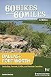
60 Hikes Within 60 Miles: Dallas–Fort Worth provides plenty of options for a couple hours or a full day of adventure, all within about an hour from Dallas, Fort Worth, and the surrounding communities.