Getting there: The trailhead starts on the sidewalk of Park Bend Drive,
just south of Parmer and MoPac. From the south take the Parmer Lane exit off of MoPac and
be prepared to turn right immediately onto Cedar Bend. Be very careful of cars on the
service road. Take the next right along the back of North Austin Medical Center and
then take the next left onto Park Bend Road. The trailhead will be on the right, just
beyond the water containment basin. From the north, take the Waters Park Road exit off of
MoPac and pass over Parmer Lane. Go to the next traffic light and turn left onto Park
Bend Road. Park along the street next to the sidewalk that runs toward Walnut Creek.
The Hike: This hike is as easy as it gets. The entire length of the
hike is paved and the distance short. It's easy enough to the point that one hesitates to
call it a hike instead of a walk. But this particular outing may be ideal for an after work
hike or tryout for new boots or socks.

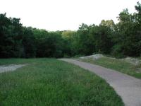
The entire length of the trail is paved, which makes for easy going.
The trail starts at the waypoint "Trailhead", right along Park Bend Road. It runs along
the earthen containment wall for the water runoff pond. Since the pond is usually dry
it's often used for pickup ball games or folks playing fetch with their dogs. The route
heads straight back towards Walnut Creek.
Upon getting closer to Walnut Creek the route veers to the left and follows Walnut Creek
downstream. On the opposite bank of Walnut Creek you should be able to see a large rock
cliff. Just a few years ago the scene was still quite wild. However apartment buildings
now loom overhead.

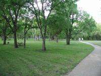
The name of this trail comes from the small park that it passes through.
When you approach the waypoint marked "Metric Cross" be prepared to pass under Metric
Blvd. and then walk up wooden ramps to the road level. Here you have to walk south along
Metric for a short distance before the walkway into Gracywoods Park continues to the left.
Note that it is possible to cross the creek without going up to Metric, but it depends
entirely on the amount of rain the area has experienced. During dry periods the water
level may be low enough to hop across a few rocks to the opposite bank.
Gracywoods Park is a small recreation area that includes a volleyball court, swing set,
gazebo and picnic benches. The heart of this area is marked by the waypoint "Park".
Upon leaving the park the route will pass through a thick section of trees and brush.
This section of the trail offers the opportunity to leave the comfort of the paved trail
and explore a little.
-small.jpg)
If you venture off the main trail you can enjoy a cliff view overlooking Walnut Creek.
Walnut Creek resides to the left of the trail here, though it can not be seen due to the
heavy vegetation. Several paths have been made through the area to get to the creek and
it's worthwhile to try them out. If you navigate your way toward the waypoint marked
"Cliff" you'll be rewarded with a wonderful rock cliff overlooking Walnut Creek. Below
the cliff there is also a wide rock bank.
The trail from this point on hugs along the boundaries of apartment complexes until it
reaches its end at the waypoint "Turnaround". Here you'll run into Bittern Hollow
Drive. Although one could start their hike at this location we would not recommend it
since parking is much less prevalent here.
As you may be able to tell from the map, the Gracywoods Park hike runs very close to the
boundary of Walnut Creek Park to the east. There is probably a way to connect one of the
trails from that park to this hike after crossing Walnut Creek. That's one connection we
will attempt to make in the future. If you know a way through please let us know.
In all we took a little over 1 hour to complete the hike out and back. This included
some time spent exploring the side trails around the cliff overlooking Walnut Creek.